Came across this neat little map yesterday on my wanderings …
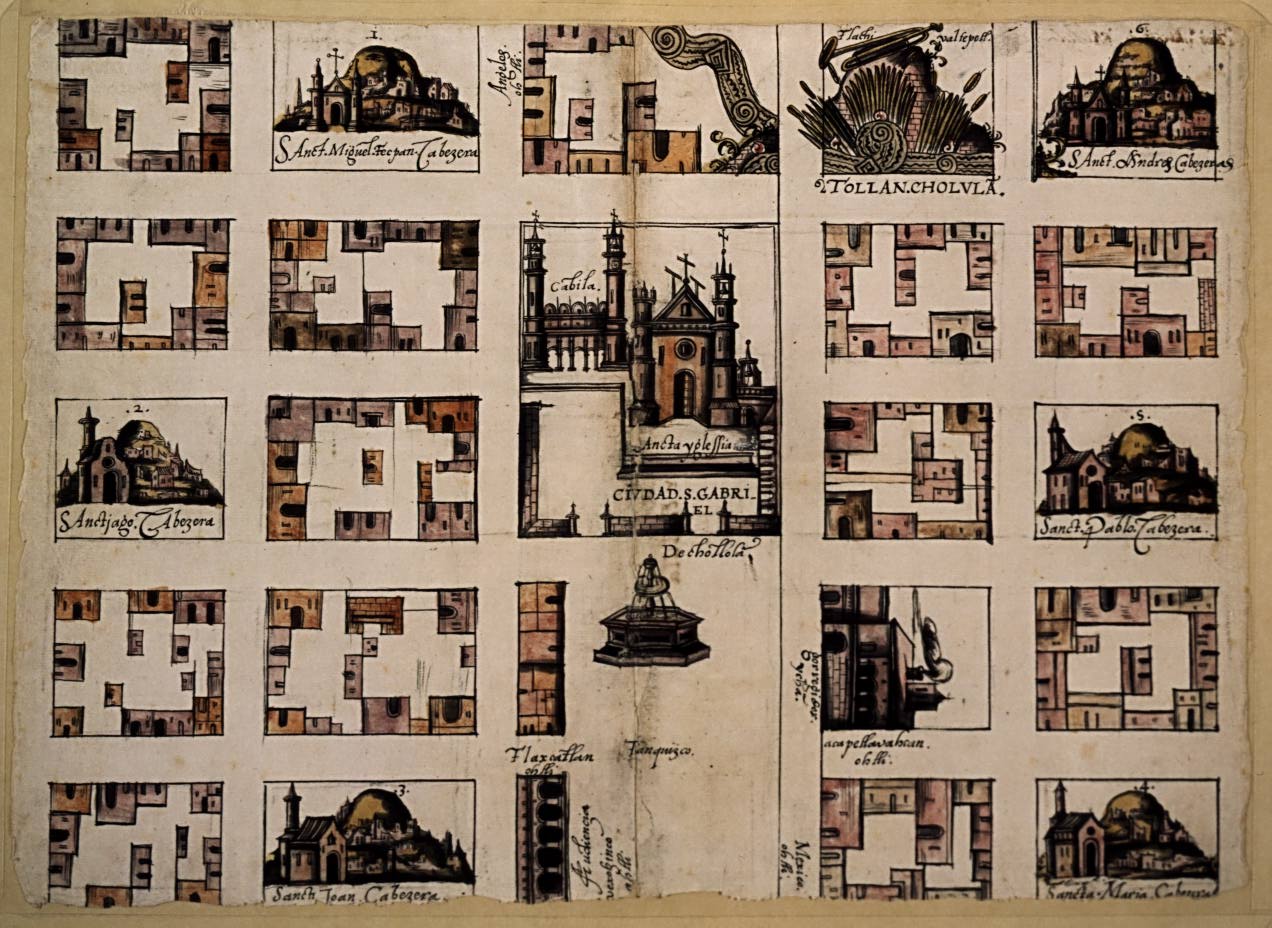
I found the little gem HERE. Apparently, it is a map of Cholula in Mexico drawn in 1581. Not a bad method for generating a fantasy city. The map actually reminds me just a bit of Zak’s Vornheim – or at least of the illustrations of Vornheim that I have seen.

Oh wow that's just fantastic, a great find. Again symbolic maps make for so much more evocative artifacts.
LikeLike
That is a seriously cool map–I've never seen anything like that before–thanks for posting it.
LikeLike
I'd bet my big toes that someone in 1581 ripped off Zak. Beware the time-travelers.
LikeLike
That is a great map. Thanks for sharing!
LikeLike
That is a great map… fantastic find! Thanks for sharing it!
LikeLike
Great map. Those are elevations of each building on the block. So what you are looking at is not the top down view, but what the street looks like as you walk it. So to read it, you have to (in your mind) turn the map so the street is at the bottom, with the building elevation above. And then you have the big elevation of the churches.
Its an old architects trick to describe what a street feels/looks like.
LikeLike